By Julie Cart. This story was originally published on February 11, 2025 by CalMatters.
Reflecting intensifying wildfires and updated science, new state maps designate more than 2.3 million acres of local land in California as facing “high” or “very high” danger of wildfires.
In the wake of devastating fires in Los Angeles County, the Fire Marshal’s office is gradually releasing updated maps for local jurisdictions after Gov. Gavin Newsom issued an executive order last week. The previous statewide maps were released from 2007 through 2011.
State officials will notify 404 cities and counties about the designation changes via a rolling regional schedule. The North Coast and Bay Area designations will be released on Feb. 24, the Central Valley and Central Coast on March 10 and Southern and Eastern California on March 24, according to the Fire Marshal’s office. Once an updated map is released, local officials have four months to incorporate the recommendations for the new hazard rating.
That’s a excerpt; read the entire article on CalMatters at : https://calmatters.org/environment/wildfires/2025/02/california-wildlfires-high-hazard-new-maps/
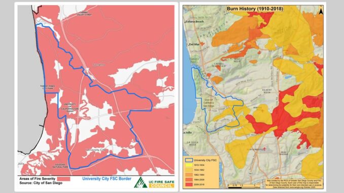
The attached maps are illustrations created in 2021 by the University City Fire Safe Council and by the Fire Safe Council of San Diego County.
This story was originally published by CalMatters. Sign up for their newsletters.


