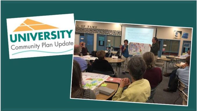
Contributed by UCCA board member Diane Ahern: The Community Plan Update Subcommittee meeting on Tuesday, April 16, 2019, was primarily a land use planning workshop. Most of the focus was the area north of Rose Canyon because of the trolley stops. Several areas with large surface parking lots and older buildings were identified as potential for redevelopment. One group suggested exceptions to height limits to allow for solar installation on roofs. Another group suggested protected bike lanes along Nobel, Governor, and Genesee. There was discussion of the open parcel canyon land that’s the extension of Robbins to the east from Gullstrand to the 805 (between Governor and Enders). Churches with lots of land were mentioned as possible sites for development including the property adjacent to the Baptist Church on Governor. Also considered under-utilized is some of the space in the office park on Greenwich as well as the land that’s now used for the Village Nursery at the east end of Governor. And seemingly there is some confusion about Miramar’s federal property boundaries. Some seemed to feel that all that open space east of 805 and adjacent to Miramar Road looked ripe for development.
Bottom line … This community plan update is not just about north University City; it’s about all of University City. There will be a more complete meeting summary in the May University City Newsletter courtesy of Katie Rodolico, UCCA’s representative to the Update Subcommittee.
If you were not able to attend but you would like to make a public coment, please take the time to submit an email comment to Marcia Garcia. She’s on the City’s planning department staff at MAGarcia@sandiego.gov
The next meeting will be the 3rd Tuesday of May; location to be determined. Please save the date.
More information about the University Community Plan Update is posted at https://www.sandiego.gov/planning/community/cpu/university
And more University City info at https://www.universitycitynews.org/category/ucpg/
Contributed by Katie Rodolico, UCCA’s representative to the Update Subcommittee: Community Plan Update Subcommittee – April 16, 2019. The meeting started with public comment: Matty Wuest spoke on the issue of flight corridors at MCAS Miramar and the impact of flights outside of these corridors; Diane Ahern spoke of the MCAS Miramar F35 flights coming to Miramar, and the heavy lift helicopters coming in a few years, and their impact on the University City community; Joe La Cava advised the subcommittee to be careful, when writing the plan, to use strong language like “require” rather than “prefer” in laying out the plan for the community.
Dan Monroe, City of San Diego, reviewed the progress on the plan so far. The results of the “vision” workshop held in March will be available at the May meeting. The community survey is being finalized. It should be circulated to subcommittee members within a few days, and the broader community in early May. The results of this survey will be discussed at the May meeting. He then turned the meeting over to Rajeev Bhatia to lead the discussion on land use.
Mr. Bhatia presented a new generated map of “potential” land use changes. The map identified areas that could have increased density or land use changes. The meeting then broke up into smaller groups to identify and comment on this map. Unfortunately, the map did not have current information and much of the discussion was spent noting the areas that already had new or planned densification in progress. Dyett and Bhatia agreed to do ‘ground verification’ before the next meeting.
The groups presented their ideas. The ideas included several ideas for the light industry near the 805 and Miramar road. Discussion of the Coastal Overlay Zone height limits for the areas around La Jolla Village Square, and discussion of the need for segregated bike lanes on Genesee, Nobel, and Governor Drive.


